
Cranbrook floodplain mapping underway
Mike Matejka gives us a sketch of the need, the process and the desired results for floodplain mapping in Cranbrook

These helicopters were used to obtain the aerial photos needed for Cranbrook's floodplain mapping. — Photo courtesy Mike Matejka
In August the City of Cranbrook received a federal grant of $100,000 for floodplain mapping from the National Disaster Mitigation Program. Summer is the peak time for such projects as paving, road reconstruction and utility reconstruction, and it’s also the best time for doing the aerial photography that is the foundation for floodplain mapping.
Mike Matejka, the manager of Cranbrook’s Infrastructure Planning and Delivery Division, manages the City’s capital projects mentioned above, and he explained some of the elements that go into creation of a floodplain map.
“The LiDAR (Light Detection and Ranging—laser-based technology that uses drones or other aircraft to create a profile of the surface of the relevant terrain) and orthophoto work was done in July, and the post-processing work is well underway,” Matejka said. “Once that’s completed, we’ll work with our consultants to generate the storm model that will show the potential flood-risk areas.”
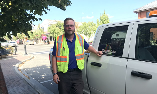
Mike Matejka, manager of Cranbrook’s Infrastructure Planning and Delivery Division, talked to us about the need for and process of obtaining a floodplain map for the city. — Marie Milner photo
Protection for just-in-case
The risk of generalized flooding in Cranbrook is low, given the city’s distance from a large water course. “Fortunately, although Joseph Creek certainly can flood, it’s a small creek and the consequences of a flood would be limited,” Matejka said.
However, Cranbrook’s administration is installing protections that will be needed in the event of a once-in-200-year flood. Matejka explained that the first grant the City received for this project, two years ago, was for a risk assessment that showed critical infrastructure.
The floodplain mapping will provide a detailed model showing where flood water would collect and what flood water would do in those areas—its depth and the velocity of its flow. Analysis will reveal the likelihood and severity of potential flooding, and its consequences. With that information, the City can plan for needed structural or protective work.
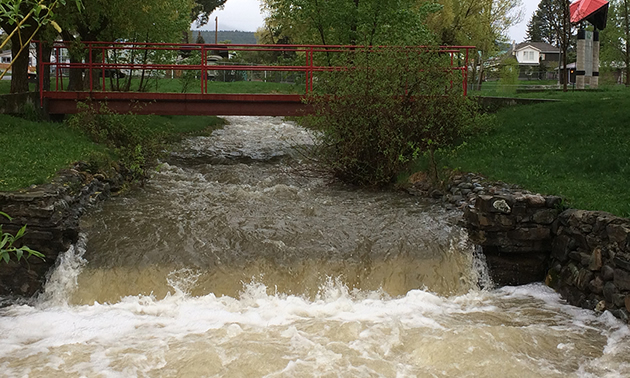
In 2017, Joseph Creek overflowed its banks during the higher-than-usual spring freshet. — City of Cranbrook photo
Already in progress
Work has already been done to increase the capacity of the storm trunk drains that carry flows from Jim Smith Creek and Hospital Creek through an area that runs parallel to Kootenay Street—an area that has often had flooded basements and boggy back yards.
“We want to enhance the creek for ecological values as well as for flood mitigation,” Matejka said.
The habitat restoration work being planned for Joseph Creek will also lower the risk of creek overflow. Removal of the non-native yellow willows will significantly improve water flow and creek capacity, and the restoration of native plants will bring back nesting birds, insects and the native fish that feed on them.
Government regulatory bodies have high standards and strict guidelines for the work and habitat improvements they will fund.
“It can take a few years from the time that we have the money to do the work to the time we get approval for it,” Matejka said. “We want to speed up the process, and we’re trying to do what’s necessary to build confidence that we’ll be doing this right: we’re using sound science, we’re doing the right engineering and consulting, and we’re looking at the ecological standpoint and the potential risks. The mapping will also help with future land-use decisions.
“If the City is going to be doing work on the creek or anything related to it, including flood management, it’s important that the citizens understand the reasons for the projects—all the aspects that will be affected and what we’re working to achieve.”


Comments