
Mapping natural resources
Technology is giving geologists a better picture of what lies beneath
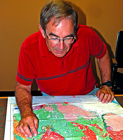
Peter Klewchuk has a wealth of experience under his belt. — Trevor Crawley photo
Mapping technology has evolved to give geologists a better picture of natural resources hidden under the Earth’s crust.
Gone are the days when geological explorers would rough out mineral deposits on paper based on rock formations and other landscape clues.
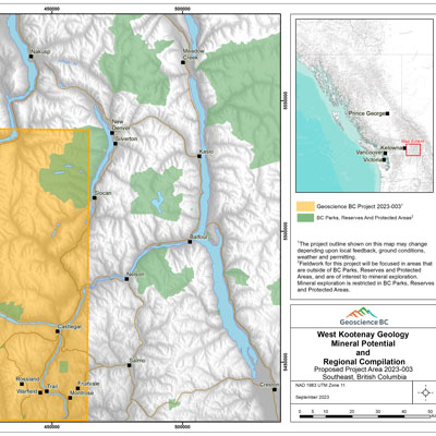
Geologists can now accurately pinpoint deposits by combining scientific techniques like soil sampling with geographic base data such as contour lines and water features.
Peter Klewchuk, a geologist based out of Kimberley, B.C., has been in the mineral exploration business for more than 40 years and has personally witnessed the evolution of mapping techniques and technology.
“Now a lot of guys just map on their GPS (Global Positioning Satellite) unit and download everything right onto a map so they can print out the results of their daily work and see what’s accumulated on their project anytime they want to,” he said.
It was the love of nature and the opportunity to be outdoors that drew Klewchuk to mineral exploration.
Finding deposits is a combination of different science disciplines like geophysics and geochemistry with a touch of informed guesswork, he said.
Klewchuk has been around the world over the course of his career, spending 12 years with Teck Cominco where he worked at the Black Angel mine in Greenland as well as other projects around the U.S. and the Canadian Northwest Territories.
He is now semi-retired in Kimberley where he’s done some exploration work for junior mining companies in the surrounding area.
Sheila Churchill, program head for the GIS department at the British Columbia Institute of Technology, says data used to take much longer to analyze before digital mapping software was available.
With software like ArcGIS or MapInfo, geologists can take different kinds of data such as geology formations and fault lines and blend them all together on a map with a database electronically attached.
In the days before digital mapping, adding additional information was done with mylar sheets, a clear, see-through material placed over a paper map to isolate one data set from another.
Now, when data is in digital format, mineral explorers can add and remove information and accompanying databases with the click of a mouse.


Comments